Fewer device changes
Select routes, check status and control supported payloads on a compatible controller, reducing device changes in the field.
 Contact Us ↗
AGS is a controller-based ground station for bridge drone inspection, connecting ARP plans with field operations through route management, 3D awareness, simulation, imaging and pilot intervention.
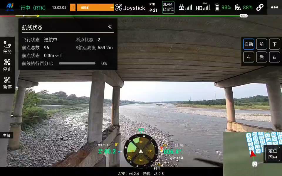
Select routes, check status and control supported payloads on a compatible controller, reducing device changes in the field.
Combine the bridge model, route, live pose and video to understand where the aircraft is and what it is doing.
Pause, return and manual takeover controls help pilots respond to environmental and equipment conditions.
Load the same 3D bridge model used in ARP and overlay routes, waypoints and live aircraft position and attitude. Understand spatial relationships around piers, towers and cables, and distinguish completed from pending waypoints.
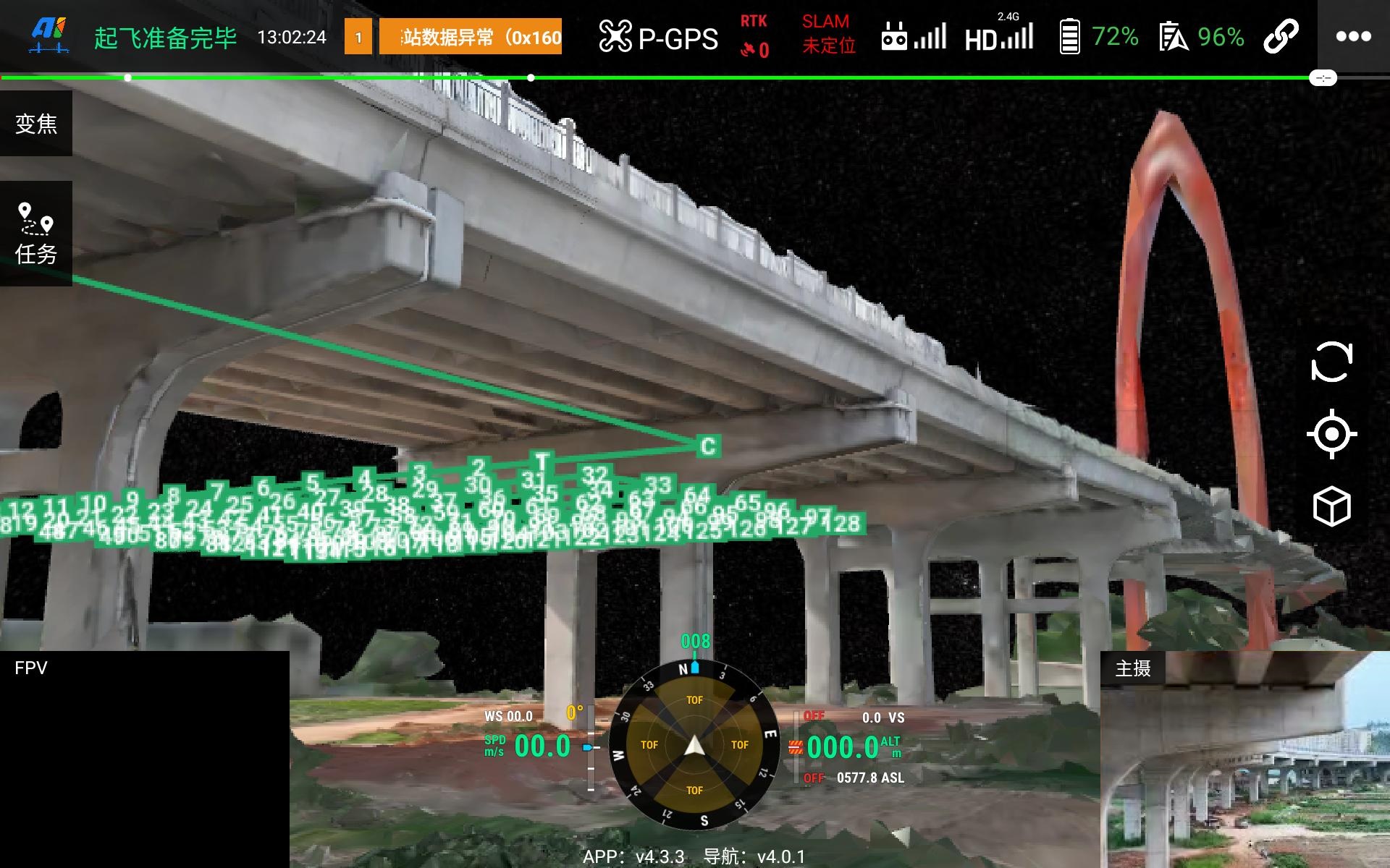
The 3D view supports decisions; it does not replace field observation, flight safety assessment or applicable operating requirements.
Import an ARP route and start simulated execution through AGS. Review the flight sequence, mission progress and status feedback in the 3D bridge scene before fieldwork.
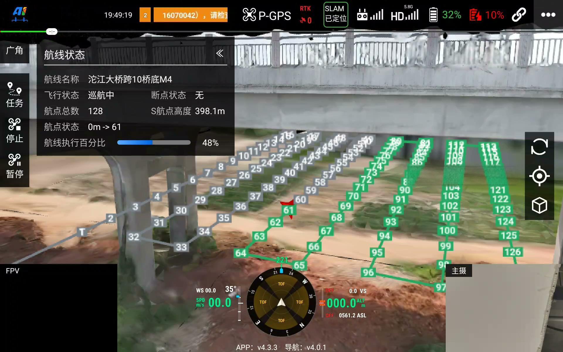
Review paths, waypoint camera directions and spatial relationships with bridge components.
ARPRehearse mission execution, controller operations and status feedback, with payload integration checks where supported.
Simulation and physical payload tests require different setups. Real gimbal and capture tests require compatible onboard equipment and a camera. Simulation does not replace site surveys or live-flight validation.
Manage ARP KML missions and select segments for field conditions. After battery changes, interruptions or repeat imaging, pilots can confirm resumption from a recorded checkpoint or selected waypoint, reducing repeated work.
Organize M400 and M4 missions separately, subject to project compatibility, for broad-area and confined-space capture. Multi-model support does not mean controlling multiple aircraft simultaneously from one controller.
View waypoints, action progress, battery, connectivity, RTK/SLAM status and alerts. AGS provides displays and operator controls; INES handles onboard positioning and route execution. Pilots assess these alongside video and field conditions.
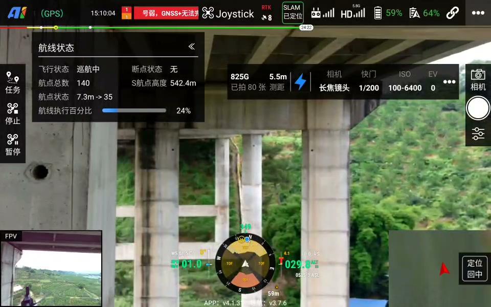
Use FPV, the main camera or picture-in-picture to check the environment and image quality. Adjust supported focus, exposure and gimbal controls, and monitor photo counts and storage to identify capture issues early.
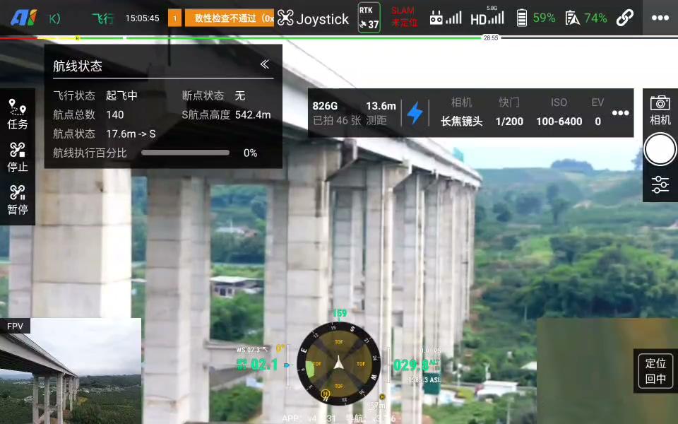
When conditions change or alerts occur, pilots can choose to pause, return or take manual control. Actions depend on flight control, communications, positioning and project configuration; controls do not replace field risk assessment.
Tell us about your bridge, aircraft and payload so we can help identify the right AGS setup for your project.
Last updated