Field Route Capture
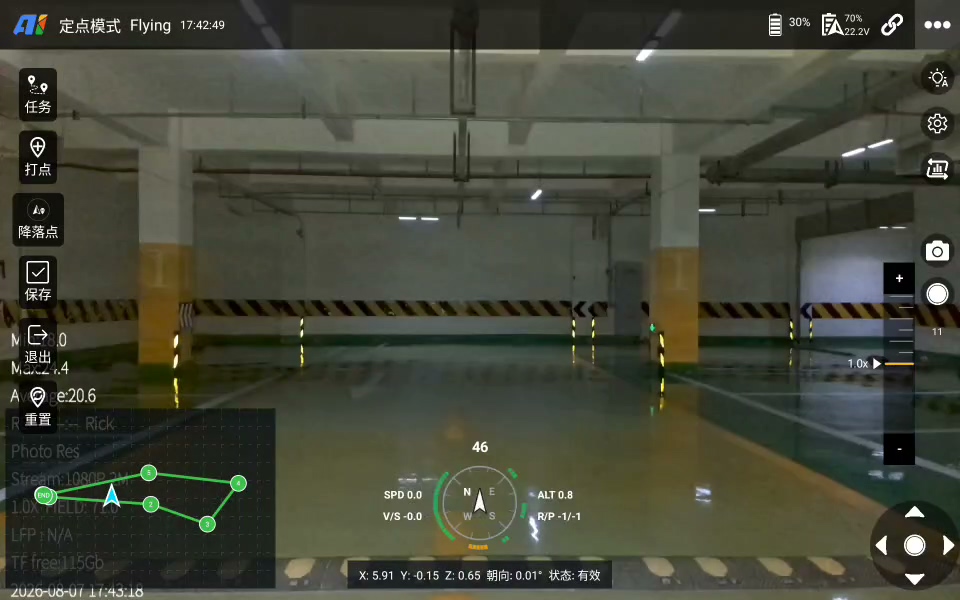
During the first entry into an unknown or complex space, the pilot explores the route and records photo and position waypoints at key locations.
 Contact Us ↗
Designed for GNSS-denied indoor and confined environments with complex structures, AGS connects field route capture, planned missions, live video and flight status on a professional smart controller, helping teams build reusable inspection missions.
Confined spaces often lack ready-to-use maps, while structure, occlusion and access conditions cannot be fully judged from documents alone. AGS lets pilots explore and record during the first operation, turning one field flight into a reusable route and map.
When a confirmed plan is available, AGS serves as the mission execution and monitoring entry point, coordinating with ARP, INES and I5 / I7 drones.
During the first entry into an unknown or complex space, the pilot explores the route and records photo and position waypoints at key locations.
After the flight, the route and point-cloud map provide a reusable field foundation for repeat missions or further planning.
Import a confirmed route and point-cloud map and coordinate with onboard navigation to localize and execute inspection missions in GNSS-denied environments.
View the 2D route, aircraft position, mission progress, main-camera video and key flight status together on the controller.
The two modes can be used independently or connected around the same site. Mission scope is determined by the aircraft, payload, communication conditions and site safety requirements.
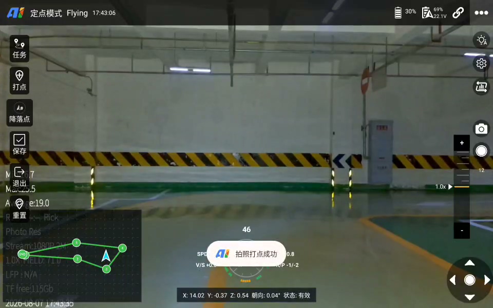
The pilot observes the environment through the main-camera view, follows a passable route and records key points for imaging, turns and obstacle bypass. The route and point-cloud map are retained for the next operation.
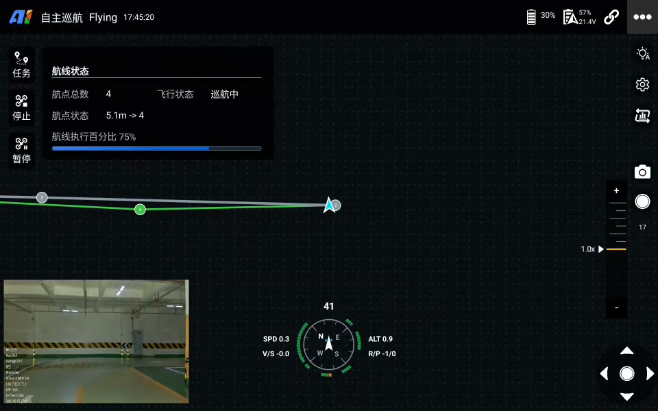
Import the reviewed mission route and corresponding point-cloud map. INES coordinates positioning and onboard execution while the pilot tracks progress through the 2D map, live video and mission status.
The pilot flies into the site and observes the spatial structure and access conditions.
Add photo points where imagery is required and position points at turns, bypasses and other key locations.
Save the route and point-cloud map as a reviewable and adjustable mission foundation.
Subsequent missions can repeat the route directly or use ARP to refine waypoints, views and acquisition actions.
The 2D map presents routes, waypoints, current aircraft position and mission progress. Main and auxiliary video help the pilot assess the environment and acquisition status, while position, attitude, battery, link and alerts are shown in the same workspace.
View the current waypoint, completed segments and overall execution status.
Continuously view main-camera video and acquisition progress to assess mission quality.
Monitor flight, battery, communication and alerts, with pause, stop and manual takeover available.
This page presents general product capabilities. Actual integration must be validated for space dimensions, lighting, dust, communications, payload and operating procedures.
Organize repeat inspections along routes, facilities and priority sections.
Record reusable routes among columns, pipelines, racks and other complex structures.
Reduce personnel entry into restricted, elevated or hard-to-reach areas.
Build maps and a foundation for later autonomous operations through initial exploration.
Plan waypoints, views and acquisition actions in point-cloud scenes to create reviewable missions.
Capture field routes, dispatch planned missions and continuously monitor flight and imagery status.
Connect positioning, flight control and mission actions to execute routes onboard.
04 / FLYDesigned respectively for confined spaces and long-endurance, large-space inspection missions.
Provide the space type, aircraft and payload configuration, mission frequency and deliverable requirements, and we will help confirm the product and workflow.
Last updated