Reduce close-access entry
Use remote capture where flight and communication conditions allow, reducing the need for personnel to enter confined, elevated or hard-to-reach areas for inspection.
 Contact Us ↗
For metro tunnels, river culverts, industrial boilers, mines and enclosed warehouses with no GNSS, low light or constrained space, M3 / M4 drones equipped with INES and purpose-built I5 / I7 indoor drones work with mission software to connect mapping, planning, flight, capture, analysis and delivery.
Turn hard-to-reach spaces into repeatable inspection missions, reducing the burden of personnel entry and repeated planning.
Use remote capture where flight and communication conditions allow, reducing the need for personnel to enter confined, elevated or hard-to-reach areas for inspection.
Reuse site maps, routes and capture actions to reduce repeated mapping and planning for periodic inspections of tunnels, industrial buildings and similar spaces.
Link missions, field imagery and anomaly records for review and archiving, helping field and management teams work from the same inspection results.
The challenge is not merely flight, but maintaining positioning without GNSS, capturing consistently along planned routes and turning field data into reviewable results.
GNSS is unavailable inside tunnels, culverts, boilers and mines, requiring continuous reliable position and attitude estimates.
Pipes, brackets, bends and narrow passages coexist, leaving little flight space and making route and safety-boundary control harder.
Darkness, dust, reflections and repetitive textures hinder human observation and make stable capture and recognition more difficult.
Elevated, waterside, hazardous-gas or unknown spaces are unsuitable for prolonged personnel entry and require lengthy preparation for traditional work.
Configure the flight platform, sensing payload and software workflow around the space, environment and mission instead of applying one fixed setup everywhere.
Perform corridor patrol, equipment-state capture, point-of-interest photography and emergency investigation along preset routes.
Personnel intrusion / Forgotten tools / Water leakage / SpallingCapture imagery deep within narrow corridors to inspect standing water, blockages and visible structural anomalies.
Standing water / Blockage / Spalling / Exposed reinforcementUse protective structures, supplemental lighting and close-range flight to reduce scaffolding and high-risk personnel entry.
Coking / Deposits / Corrosion / Refractory lossAutonomously explore branching spaces with limited communications, retrace the route and optionally collect environmental data.
Spatial exploration / Collapse investigation / Personnel searchPlan routes between racks from a prebuilt map, with optional vision, QR-code or RFID mission payloads.
Location capture / Inventory / Anomaly reviewM3 and M4 can carry the INES onboard navigation module for confined-space inspection, while the purpose-built I5 and I7 indoor drones address tight spaces and long-endurance, large-space missions respectively. The platform is selected for the site boundary and connected with planning, monitoring, capture and result management.
Select the aircraft by spatial scale and mission requirements: M3 / M4 carry INES for positioning, navigation and mission execution, while I5 / I7 address confined spaces of different scales.
Fuse LiDAR, IMU and environmental data for real-time position and attitude estimation and autonomous control.
Handles device connection, map creation, mission management, flight monitoring, video viewing and safety takeover.
Design routes, points of interest, speed and capture actions on a 3D point-cloud map to create reusable missions.
Connect images, trajectories and AI results by project, supporting anomaly review, result retention and reporting.
M3 and M4 carry the INES onboard navigation module for confined-space inspection. The cage-protected I5 suits narrow spaces and close-range inspection, while I7 supports longer-endurance missions in metro tunnels and large open indoor spaces.
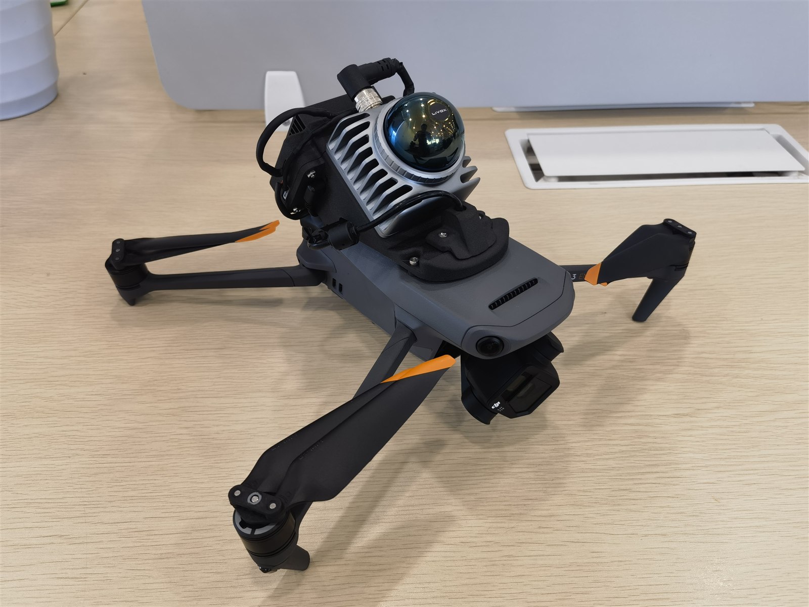
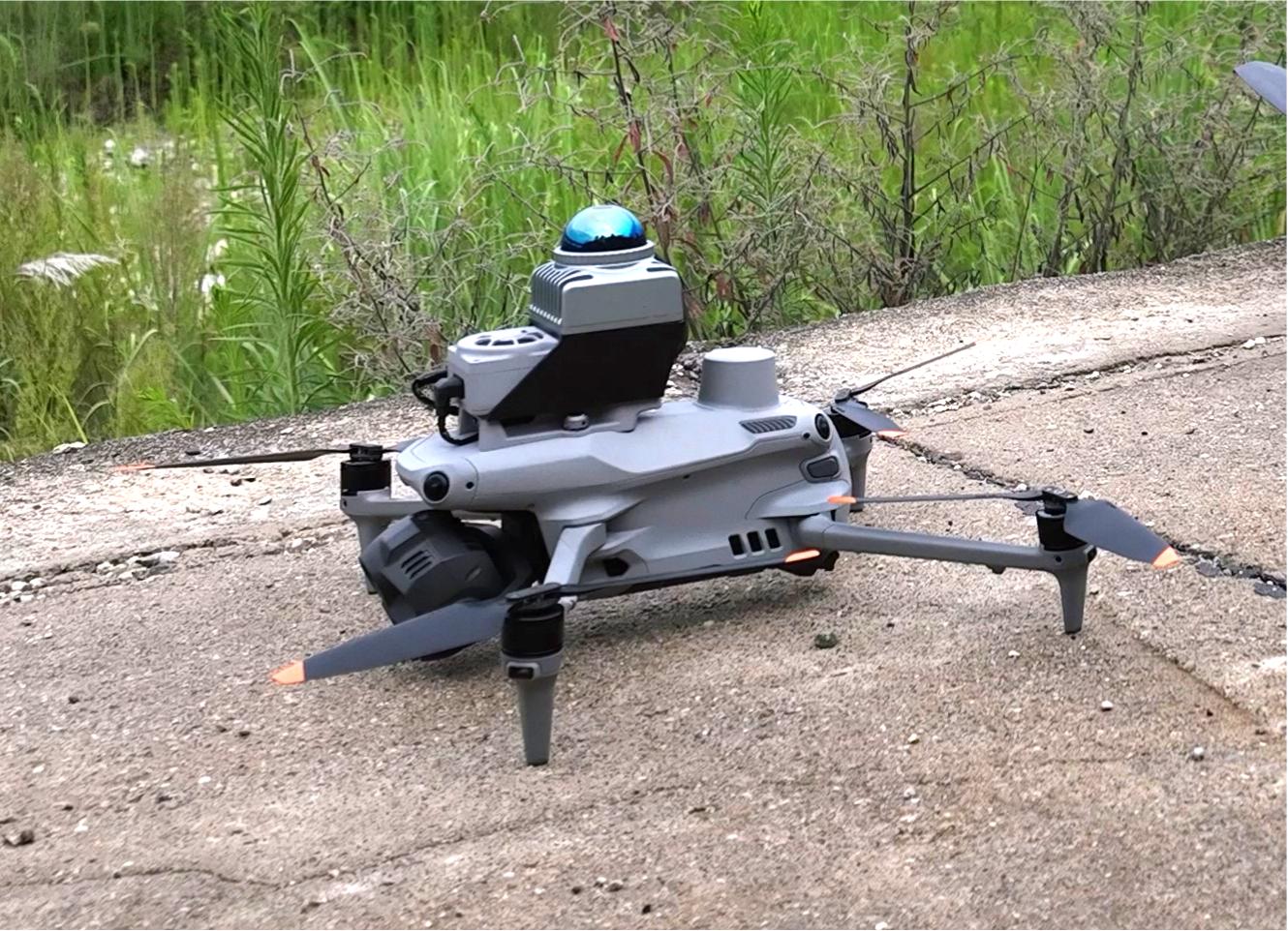
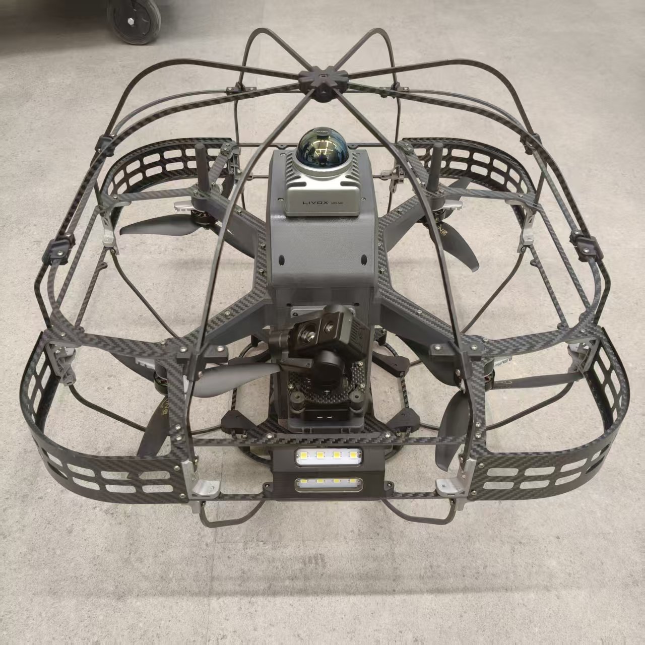
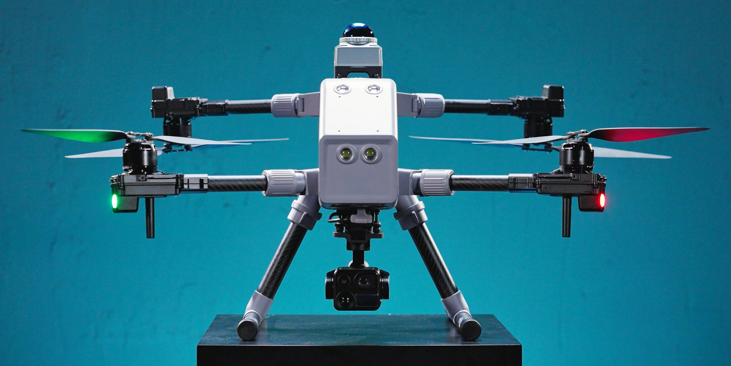
Select the aircraft according to passage clearance, obstacles, payload and endurance needs. Confirm the flight envelope and safety clearance against actual site conditions.
M3 and M4 gain confined-space positioning and navigation capabilities by carrying INES. LiDAR scans create a point cloud, while INES combines inertial and environmental information to continuously estimate position and attitude without satellite signals and control flight using the map, mission route and safety constraints.
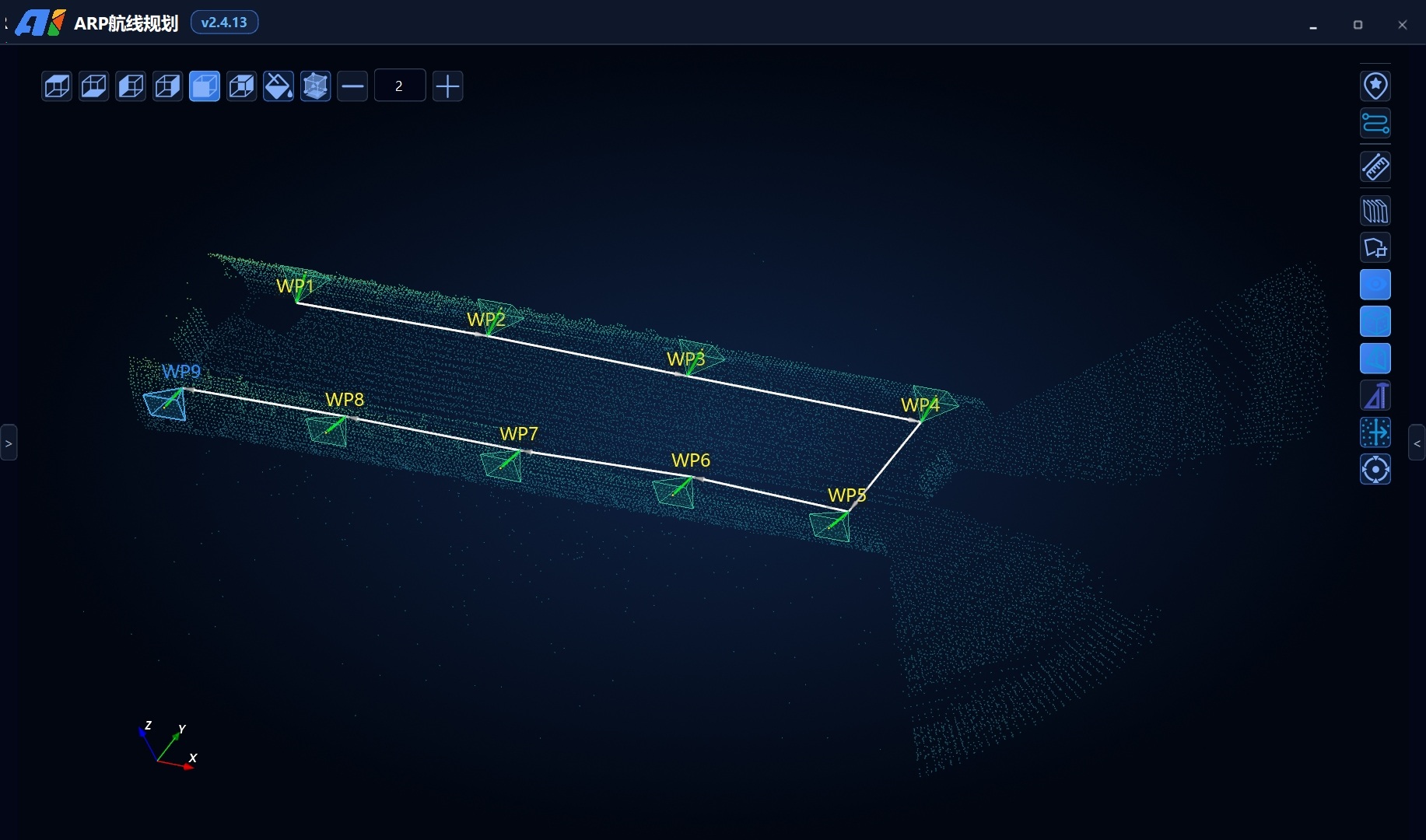
ARP plans routes and capture actions in the 3D point cloud. INES handles onboard positioning and mission execution. AGS manages field missions, monitors status and live imagery, and retains a manual takeover interface.
Explore the INES Onboard Navigation Module ↗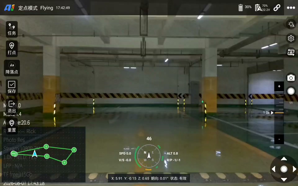
Confined-space AGS supports field execution by receiving planned missions and presenting aircraft position, attitude, device status and live video in one view, helping operators track progress while retaining essential manual intervention.
Confined-space ARP uses the site point cloud as the mission workspace to review spatial relationships before flight, organize waypoints, viewpoints and capture actions, and check routes against the environment to produce adjustable, reviewable mission files.
Scan confined spaces in real time and match the map to continuously estimate drone position and attitude without satellite signals.
Turn maps, routes, points of interest and safety constraints into executable flight missions with waypoint hover and automatic return.
Reduce flight risk through environmental perception, obstacle-avoidance strategies, low-battery or mission-threshold return and physical protection.
Configure high-resolution visible-light cameras, supplemental lighting, thermal imaging or other payloads for video, photo and environmental data.
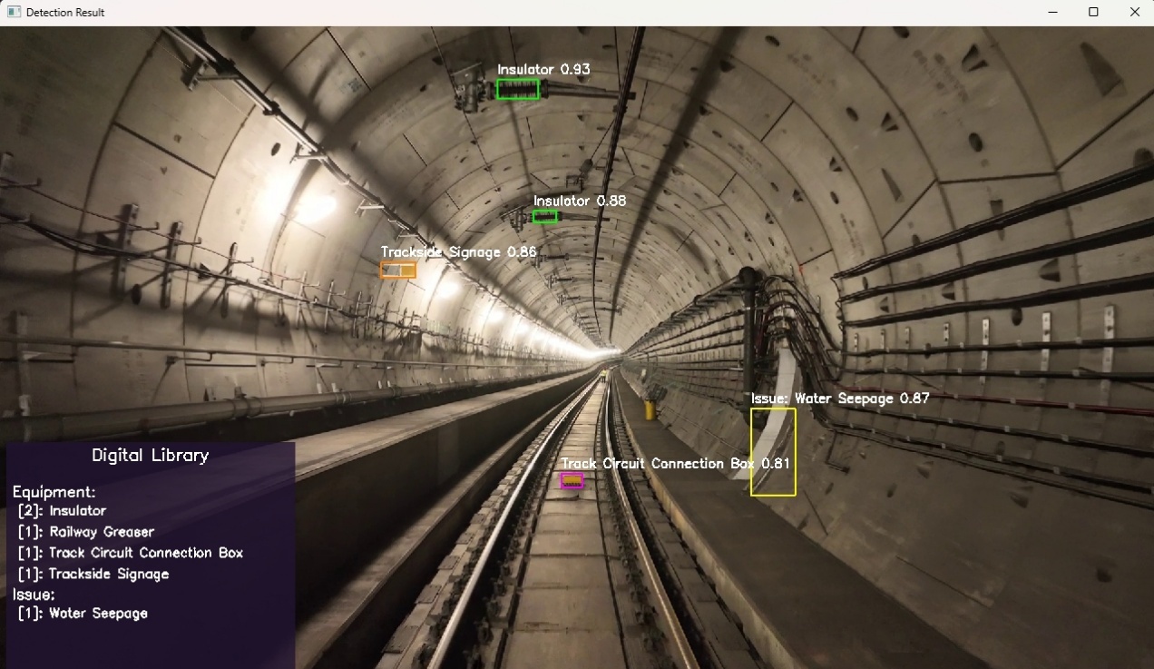
Configure project-specific models for cracks, water leakage, spalling, corrosion and other targets, outputting suspected anomalies for manual review.
From initial mapping to routine reflights, mission maps, routes, points of interest and capture actions can be reused, reducing replanning cost.
Confirm corridor structure, takeoff/landing points, lighting, communications and safety boundaries, then build a 3D map.
Configure routes, points of interest, flight parameters and capture actions in ARP to create a standardized mission template.
The drone executes the mission while AGS displays position, status and live views for corridor or waypoint capture.
Associate images and video with position, detect suspected anomalies and have domain personnel review them.
Save missions, trajectories and results for future reflights, historical comparison and reporting.
The ground station and result platform connect mission status, live video, anomaly detection and archiving into one inspection view for field teams and management.
View routes, position, device status and live video together.
Relate suspected anomalies to mission time, trajectory position and field imagery.
Archive images, video, anomaly records and review status by mission.
Organize inspection scope, findings and image evidence using project templates.
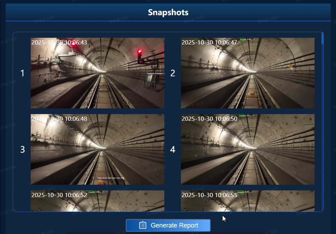
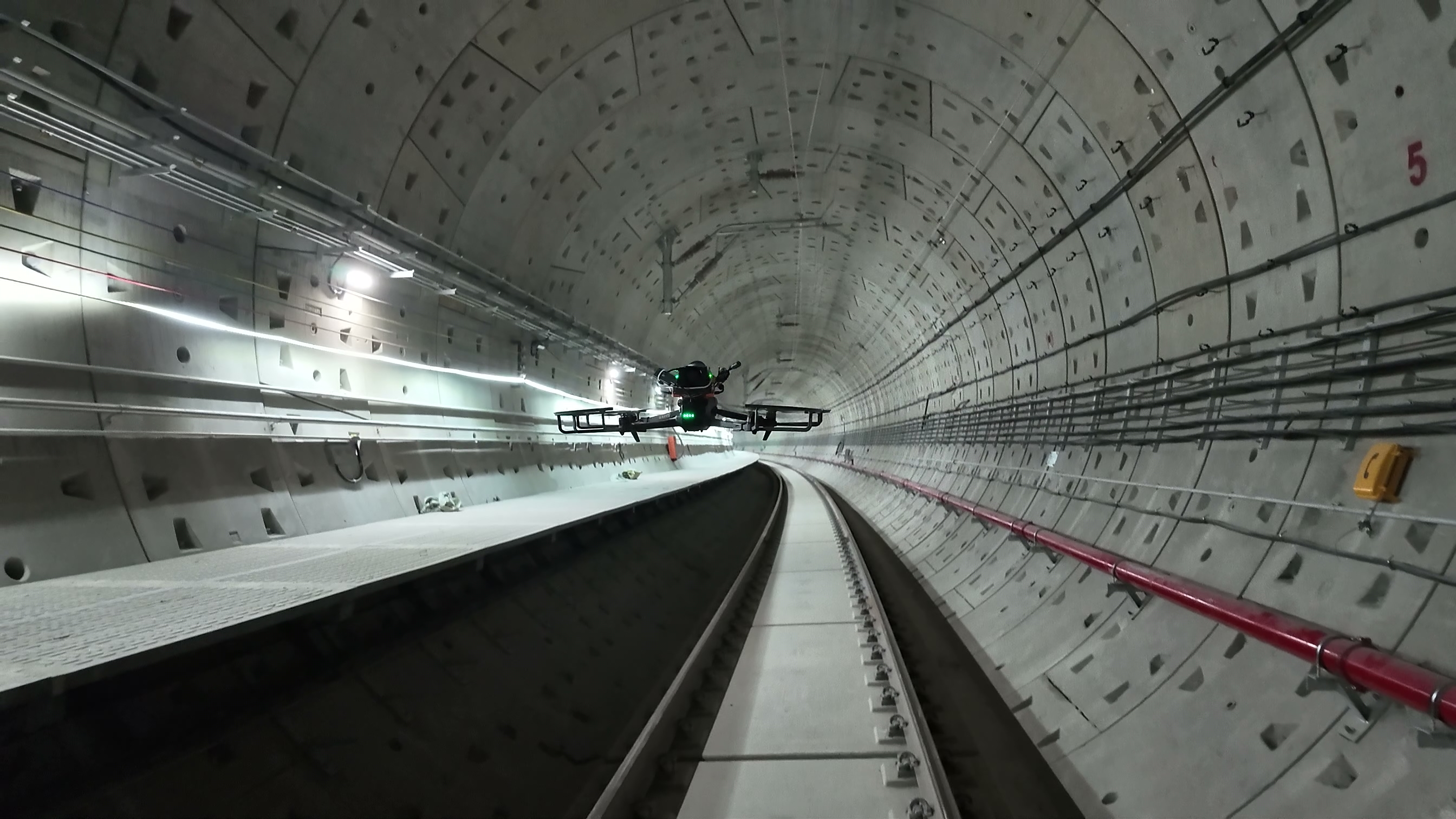
Field material shows drone cruise, altitude holding and close-range capture in curved tunnels with complex pipelines and overhead-contact equipment.
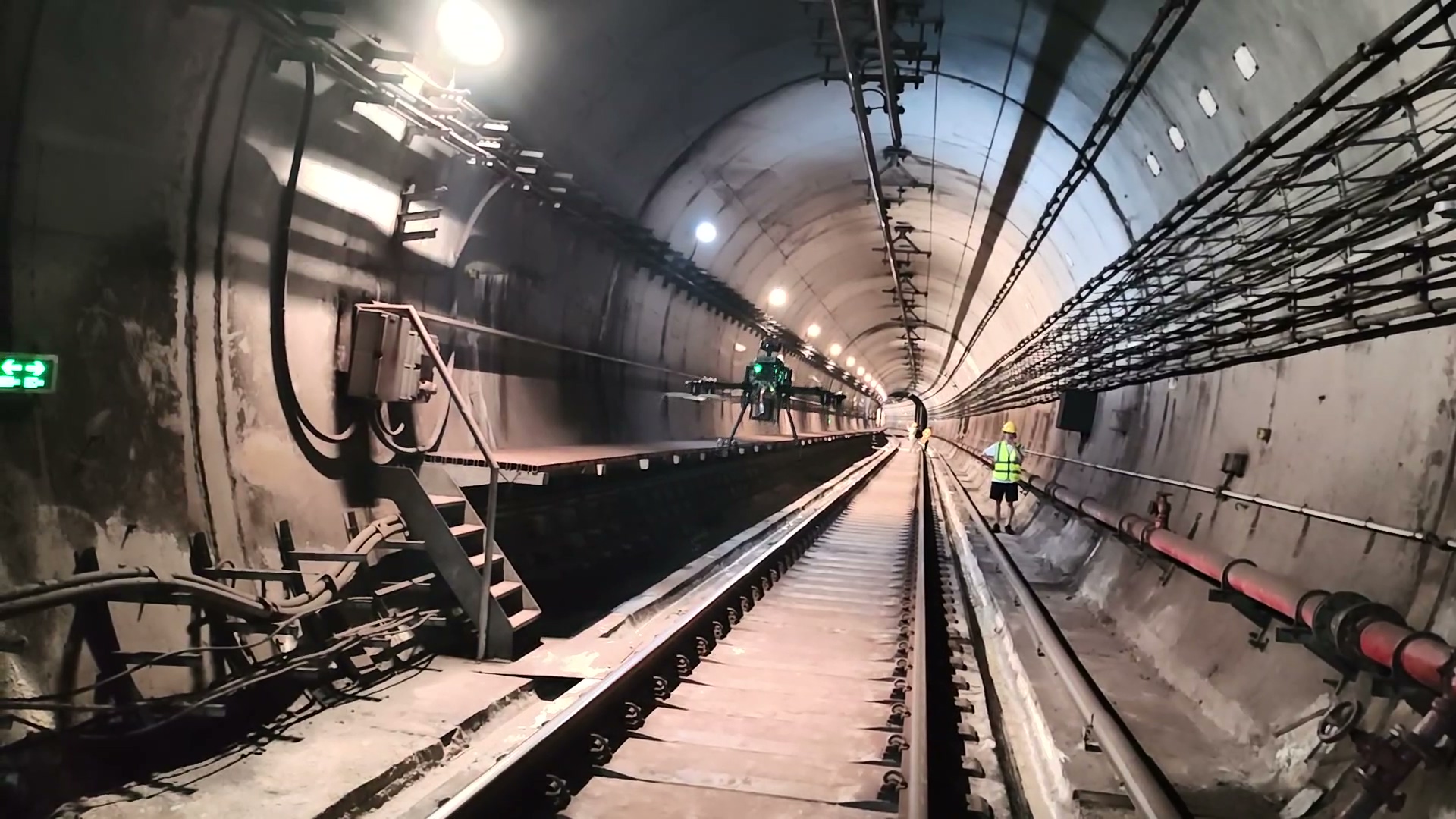
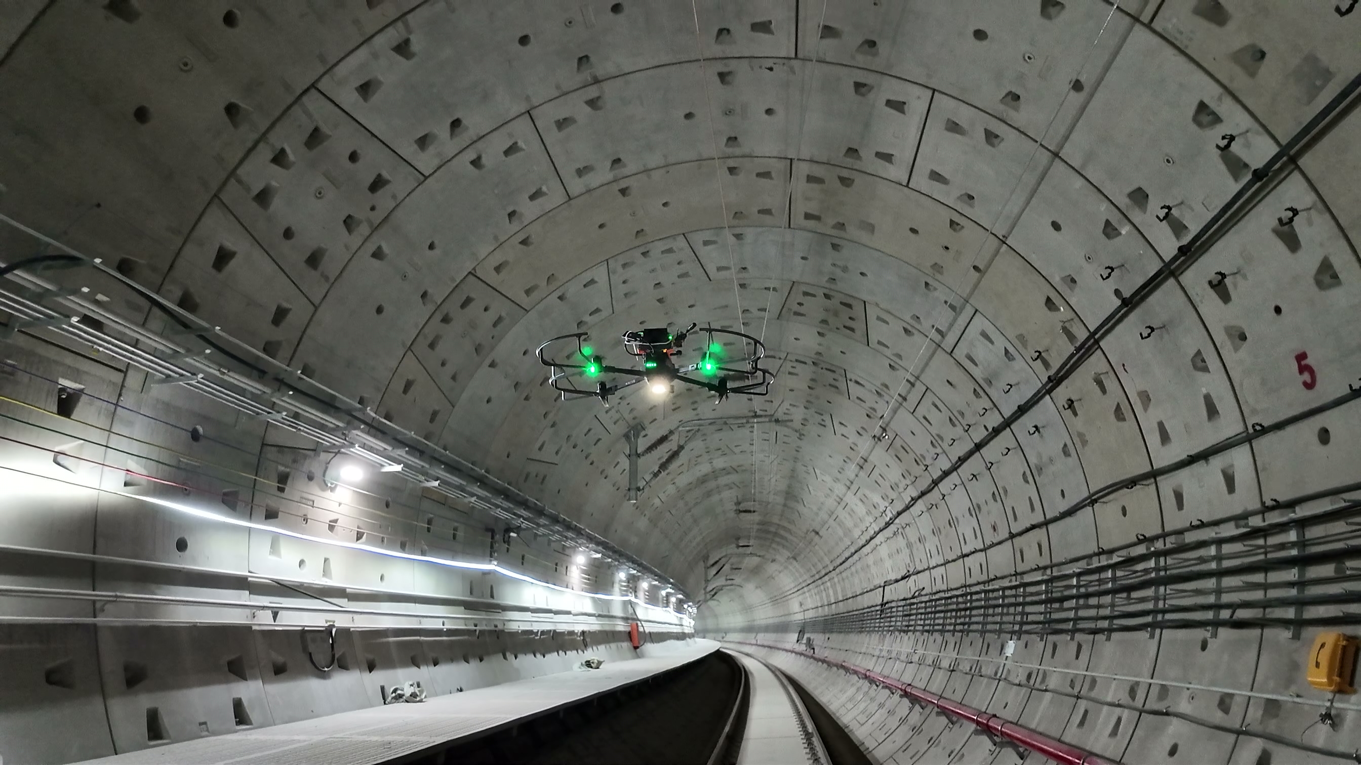
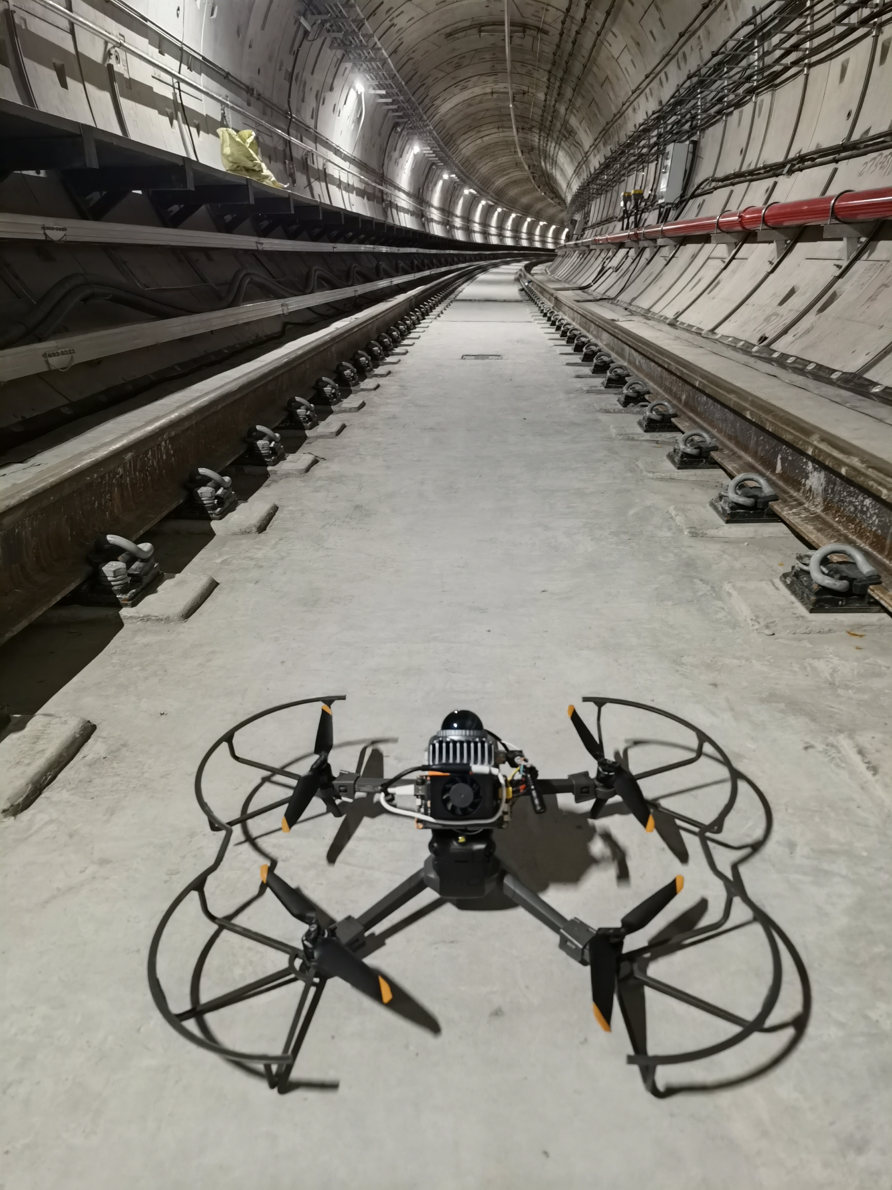
Page parameters and configurations describe capabilities. Actual range, endurance, payload, communications and recognition depend on platform, environment and acceptance conditions.
Provide site survey, equipment selection, map and route preparation, system integration, mission validation and personnel training.
Last updated