Point-Cloud-Driven Mission Space
Use a 3D point cloud for site geometry, spatial observation, waypoint editing and route review in one view.
 Contact Us ↗
For GNSS-denied or restricted environments such as tunnels, plants, warehouses and equipment rooms, the software supports spatial review, waypoint planning, view preview, action configuration and collision checks in a 3D point cloud, producing reviewable, adjustable and exportable inspection missions.
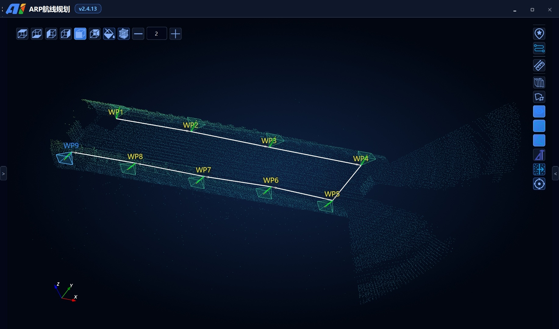
Walls, pipes, equipment and narrow passages affect visibility, routes and image acquisition. ARP uses the site point cloud as a working map so operators can inspect spatial relationships, configure waypoints and aircraft/gimbal orientation, and review each acquisition view before flight.
Planning results remain manually adjustable and reviewable, enabling project-specific routes for the spatial boundaries and objectives of I5, I7 and other integrated aircraft.
Four capabilities support mission preparation and review, helping field teams understand routes and acquisition targets before takeoff.
Use a 3D point cloud for site geometry, spatial observation, waypoint editing and route review in one view.
Reduce occlusion through sectioning and cropping to view targets inside tunnels, enclosures or equipment.
Preview camera direction and field of view from a waypoint to adjust position, yaw and pitch.
Flag potential spatial conflicts using the point cloud, aircraft radius and safety margin for iterative correction.
Every step can be revised. Before export, review point-cloud completeness, site changes, equipment status and operating procedures.
Load PCD and other project point clouds as the 3D spatial reference for route planning.
Scale, rotate and translate the scene; section internal structures with planes, combined planes or bounding boxes.
Load parameters for integrated aircraft such as I5 or I7 so planning matches platform boundaries.
Configure imaging distance, cruise speed, initial speed, default altitude and other project parameters.
Edit waypoints, yaw and camera direction and preview targets from the waypoint view.
Set takeoff/landing points and safety margins and check waypoints and segments against the point-cloud environment.
Add photo, video, gimbal and other waypoint actions and export the KML mission after review.
The software supports point-cloud scale, rotation and translation, plus sectioning or cropping with planes, combined planes and bounding boxes. Editing does not modify the source point cloud, allowing switching between overall and local views.
The waypoint list, attitude parameters and camera view are linked so mission staff can confirm target framing and adjust aircraft, gimbal and viewing distance.
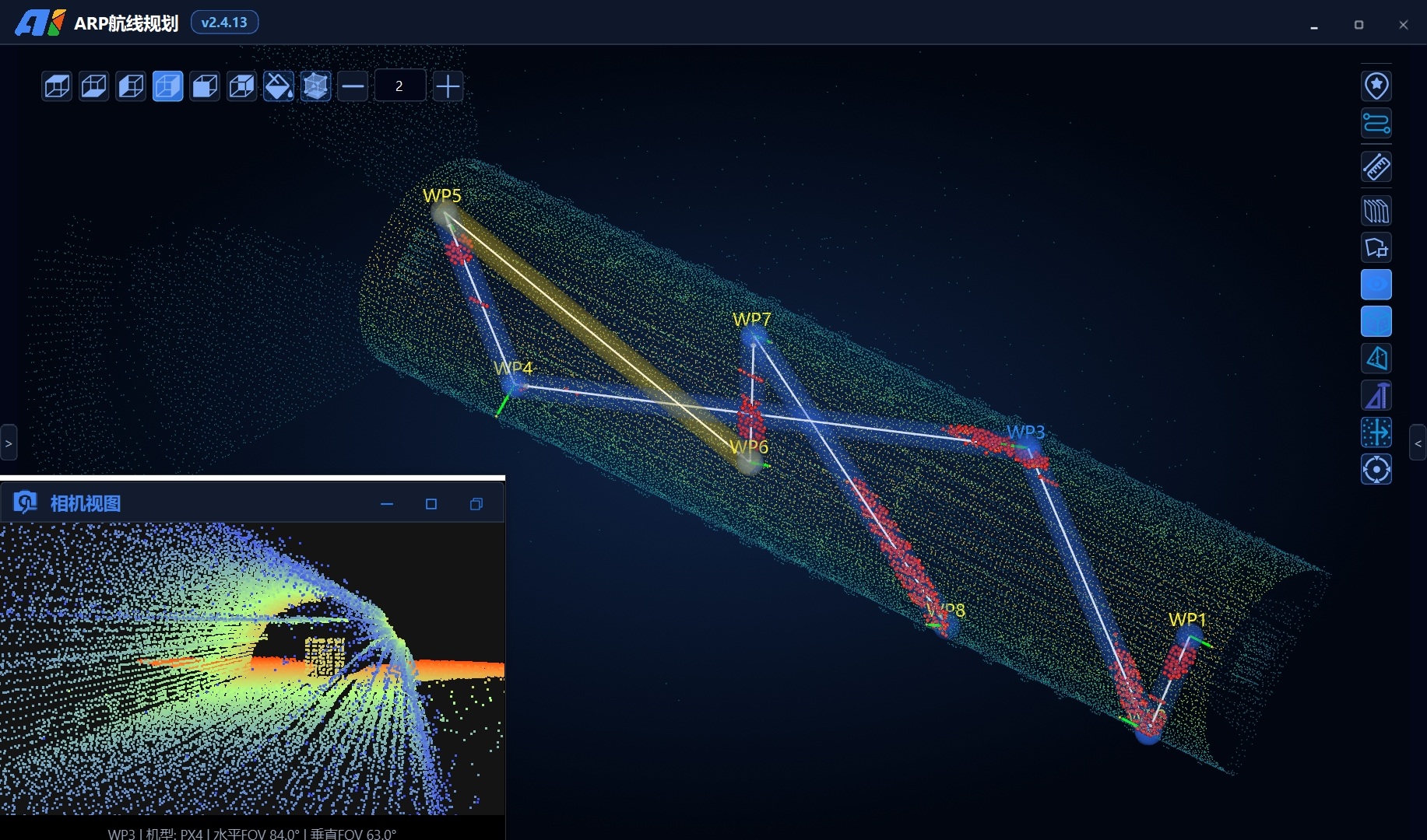
Beyond position and speed, waypoints can carry imaging, attitude, dwell and payload actions supported by the project, keeping acquisition requirements within the mission file.
Set mission dwell time at the target
Trigger image acquisition by waypoint
Set aircraft yaw and gimbal view
Use integrated camera functions
Configure auxiliary-device actions through project interfaces
Available actions depend on aircraft, gimbal, camera, lighting, software version and interface integration.
The software checks waypoints and adjacent segments using the point cloud, aircraft radius, control accuracy and safety margin, flagging positions that require adjustment for route revision and recheck.
Results depend on point-cloud completeness, coordinate accuracy, model parameters and safety margins. They cannot represent dynamic obstacles such as people or vehicles and do not guarantee flight safety. Missions still require site survey, human review, procedures and flight validation.
ARP loads spatial and mission parameters for integrated aircraft as the basis for route checks and output. Final aircraft selection must consider environment, endurance, payload and procedures.
Compact full-cage platform for narrow passages and confined environments with minor-contact risk.
Longer endurance and expansion capability for metro tunnels and large spaces.
Products collaborate through project files and workflows; specific interfaces and mission fields are subject to the delivered version and commissioning results.
Carries positioning, imaging and lighting equipment for confined-space flight.
Organizes waypoints, routes, viewpoints and mission actions from point clouds.
Imports missions, monitors status and video, and retains manual intervention.
04 / SOLUTIONCombines equipment, software, procedures and deliverables into a complete solution.
Organize repeatable cruise and acquisition missions in long linear spaces.
Plan observation paths and imaging actions around equipment, racks and elevated structures.
Use section views of complex internal structures to configure close-range waypoints.
Build reviewable missions for narrow and heavily occluded spaces.
Provide space type, point-cloud data, target equipment and delivery requirements, and we will help confirm software version, aircraft integration and mission interfaces.
Last updated